
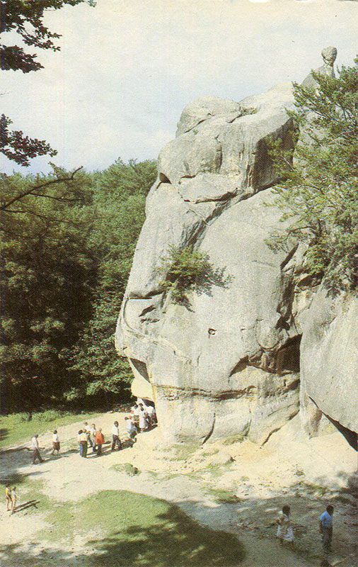
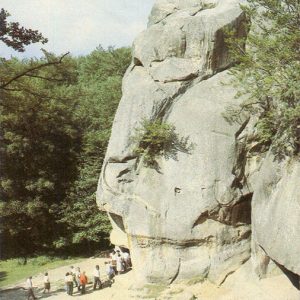
This 1990 tourist postcard features a view of the Dovbush Rock, a natural and historical landmark located near the town of Yaremche in the Ivano-Frankivsk Oblast.
What is shown on the postcard
The image captures a massive sandstone rock formation surrounded by a mixed Carpathian forest. A group of Soviet tourists is walking along a dirt path at the base of the rock. Tree crowns and a small patch of sky are visible at the top of the formation.
Historical note
Dovbush Rock is part of the “Dovbush Trail” natural and historical route, established during the Soviet era to promote tourism in the Carpathian region. The name is linked to Oleksa Dovbush, the leader of the 18th-century Carpathian opryshky movement. According to legends, these rocks served as a shelter for the rebels.
Present day
Today, the Dovbush rocks and trail are part of the Carpathian National Nature Park and remain a popular tourist destination. The route is equipped with information boards, viewing platforms, and sculptural compositions.
Location (map)
Address: Dovbush Trail, Yaremche, Ivano-Frankivsk Oblast, Ukraine
Coordinates: 48.441900, 24.571900
(Google Maps)
Coordinate source: Coordinates of the Dovbush Trail in Yaremche.
Questions and answers
- Where is Dovbush Rock located? The rock is located within the Carpathian National Nature Park near the town of Yaremche, Ivano-Frankivsk Oblast, Ukraine.
- Who is the rock named after? It is named after Oleksa Dovbush, the leader of the 18th-century Carpathian rebel movement known as the opryshky.
- What is depicted on the 1990 postcard? The postcard depicts a group of tourists at the base of a massive sandstone cliff surrounded by Carpathian forest.
See also
The «Old Postcards» archive includes other views of Yaremche from 1990.

Reviews
There are no reviews yet.