

A 1987 Soviet postcard depicting the Ivano-Frankivsk Local History Museum, housed in the former city hall.
What is shown on the postcard
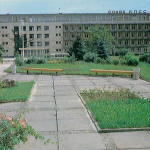
The postcard captures the monumental building of the Ivano-Frankivsk Local History Museum, which is the interwar-rebuilt city hall featuring a distinctive high tower. The foreground shows a landscaped public square with walkways, benches, young trees, and resting citizens.
Historical note
The city hall building in Ivano-Frankivsk (then Stanisławów) suffered destruction and underwent reconstructions over the centuries. The current Constructivist structure was built between 1929 and 1935 according to the design of architects Stanisław Trela and Jan Tomasz Bronowicki. In the Soviet era, the building was adapted to house the regional local history museum.
Present day
Today, the former city hall remains the architectural centerpiece of central Ivano-Frankivsk and a city landmark. The building still houses the Ivano-Frankivsk Local History Museum, which preserves a rich collection of exhibits on the history and ethnography of the Subcarpathian region.
Location (map)
Address: 4A Halytska Street, Ivano-Frankivsk, Ukraine
Coordinates: 48.922800, 24.710700
(Google Maps)
Coordinate source: Coordinates of the former Ivano-Frankivsk city hall (now the local history museum).
Questions and answers
- What is depicted on the postcard? The building of the Ivano-Frankivsk Local History Museum in 1987.
- What architectural style is the building designed in? The city hall building was constructed in the Constructivist style.
- What year is indicated in the postcard description? 1987.
See also
The «Old Postcards» archive includes other views of Ivano-Frankivsk from 1987.

Reviews
There are no reviews yet.