
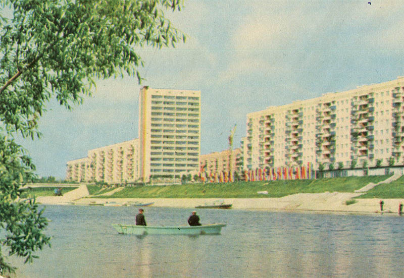
This color postcard from 1970 showcases a scenic panorama of Rusanivka, one of the world’s first major residential areas built entirely on reclaimed land in the Dnieper River floodplain in Kyiv.
What is shown on the postcard
The image captures the Rusanivka bypass canal, with a small motorboat carrying two people in the foreground. On the opposite reinforced bank of the canal, multi-story residential buildings rise: a long nine-story apartment block and a single sixteen-story tower block. A large slogan reading “СЛАВА СТРОИТЕЛЯМ!” (Glory to the Builders!) is installed on the grassy slope of the embankment. Branches of a tree are visible in the left foreground, and a construction crane’s boom can be spotted behind the buildings in the background.
Historical note
The planning and development of Rusanivka began in 1961 under the direction of architects H. Kulchytskyi and V. Ladnyi. To protect the area from seasonal flooding by the Dnieper, the entire territory was raised by several meters using hydraulic sand-filling. The artificial bypass canal, spanning approximately 2.7 kilometers around the island, served both an aesthetic and a practical drainage purpose. By 1970, when this postcard was made, most of the neighborhood was complete with modern apartment blocks and experimental high-rises.
Present day
Today, Rusanivka maintains its status as a green and prestigious residential district of Kyiv, often referred to as the “Kyiv Venice”. The canal is equipped with unique light-and-music fountains, which were fully reconstructed in the 2010s. The Soviet-era housing stock is seamlessly integrated with the developed embankment infrastructure, making it a highly popular recreational spot for both locals and visitors.
Location (map)
Address: Entuziastiv St, Kyiv, Ukraine
Coordinates: 50.438500, 30.597500
(Google Maps)
Coordinate source: Coordinates of the canal embankment along Entuziastiv Street, Kyiv..
Questions and answers
- In what year did the construction of Rusanivka begin? The planning and development of Rusanivka began in 1961.
- How was the Rusanivka area protected from Dnieper floods? To protect the area from seasonal flooding, the territory was raised by several meters using hydraulic sand-filling.
- What is the length of the Rusanivka bypass canal? The length of the artificial bypass canal is approximately 2.7 kilometers.
See also
The «Old Postcards» archive includes other views of Kyiv from 1970.





Reviews
There are no reviews yet.