
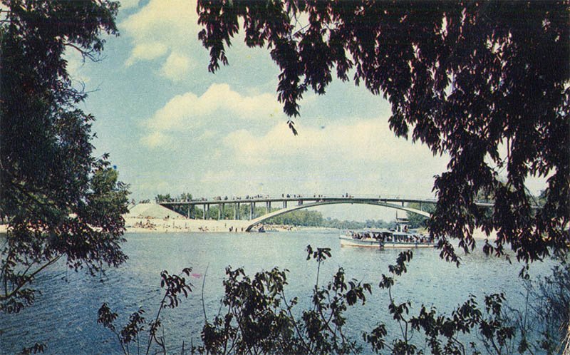
A 1970 Soviet color postcard depicting the pedestrian Venetian Bridge over the Venetian Strait in Kyiv’s Hydropark.
What is shown on the postcard
In the foreground of the postcard, tree branches create a natural green frame for the shot. In the center, the single-span arched concrete Venetian Bridge is visible with people walking across it. Beneath the bridge, a small passenger river vessel carrying people navigates the water. In the background, a sandy beach with vacationers and trees on the opposite bank are visible under a cloudy sky.
Historical note
The Venetian Bridge is a pedestrian bridge connecting the Venetian and Dolobetsky islands in Kyiv. It was built in 1966 according to a design by the Ukrproektstalkonstruktsiya institute (engineers V. I. Koval and Y. B. Ladoha) to provide easy access to the beaches of Dolobetsky Island as part of the developing Hydropark water-recreation complex.
Present day
Currently, the bridge continues to function as an essential element of Kyiv’s Hydropark infrastructure, remaining a popular pedestrian route and viewing platform. In 2013, a major reconstruction of the bridge was carried out, during which the pedestrian surface was renewed and the structural elements were reinforced.
Location (map)
Address: Venetian Bridge, Hydropark, Dnipro Raion, Kyiv, Ukraine
Coordinates: 50.447514, 30.581534
(Google Maps)
Coordinate source: Venetian Bridge, Hydropark, Kyiv.
Questions and answers
- When was the Venetian Bridge in Kyiv built? The Venetian Bridge was constructed and opened in 1966.
- Which islands does this bridge connect? The bridge connects the Venetian and Dolobetsky islands in the Dnipro River basin.
- What is the modern state of the structure? The bridge functions as a vital pedestrian infrastructure object in Kyiv’s Hydropark, having undergone a major renovation in 2013.
See also
The «Old Postcards» archive includes other views of Kyiv from 1970.





Reviews
There are no reviews yet.