
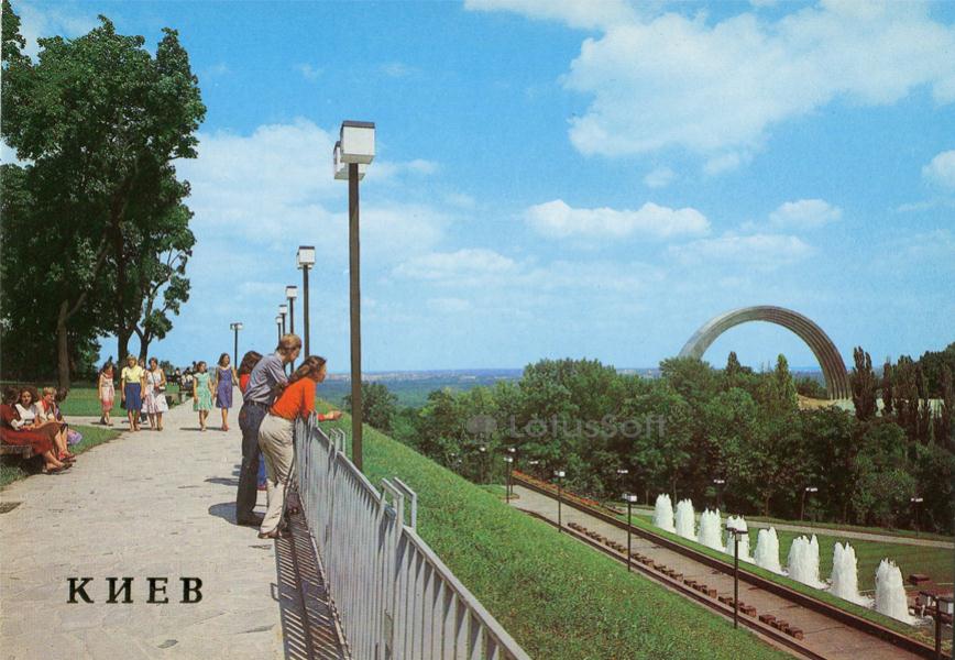
A collectible 1986 Soviet postcard featuring the scenic park zone overlooking the Dnipro River in Kyiv, capturing the viewpoint of Khreshchatyi Park.
What is shown on the postcard
The postcard shows a pedestrian alley and observation deck in Khreshchatyi Park (then known as Pervomaysky Park). Along the paved pathway, metal railings and tall post-mounted square park lanterns typical of the 1980s are installed. In the background to the right, the large metal Arch of People’s Friendship (now the Arch of Freedom of the Ukrainian People), built in 1982, is visible. Below the slope, a lower terrace features an active cascade of fountains. Several visitors in summer clothing are seen walking along the path.
Historical note
Khreshchatyi Park was originally established in the 19th century as the Merchant’s Garden. In the Soviet era, it underwent several redesigns. In 1982, to commemorate the 1500th anniversary of Kyiv, a monumental complex centered around a 35-meter-tall titanium arch was erected here. The lower terrace of the slope was embellished with fountains and paths connecting the hill to Poshtova Square and the Dnipro embankment.
Present day
Today, this area remains a prominent tourist and recreational destination. In 2022, the arch was officially renamed the Arch of Freedom of the Ukrainian People, and the Soviet-era bronze statues beneath it were dismantled. The pedestrian infrastructure was modernized, and a new glass-paneled pedestrian and bicycle bridge now links Khreshchatyi Park to Volodymyr Hill.
Location (map)
Address: Khreshchatyi Park, Volodymyrsky Descent, Kyiv, Ukraine
Coordinates: 50.453900, 30.528300
(Google Maps)
Coordinate source: Coordinates of the observation deck in Khreshchatyi Park near Volodymyrsky Descent.
Questions and answers
- What monumental structure is visible in the background? The background features the prominent metal arch completed in 1982, currently known as the Arch of Freedom of the Ukrainian People.
- What was the name of the park in 1986? In 1986, the park was known as Pervomaysky Park; today it is named Khreshchatyi Park.
- What are the water features shown below the pathway? The image shows a cascade of decorative park fountains operating on the lower terrace, constructed during the early 1980s landscape modernization.
See also
The «Old Postcards» archive includes other views of Kyiv from 1986.





Reviews
There are no reviews yet.