
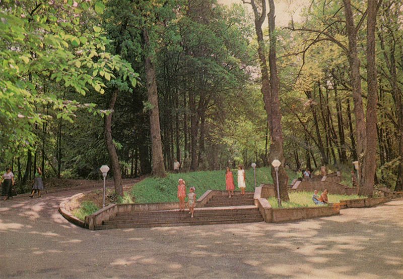
This 1982 Soviet postcard shows a scenic corner of the Resort Park in Truskavets, a famous balneological resort in the Carpathian foothills of Ukraine.
What is shown on the postcard
The image captures a park area featuring asphalt pathways, reinforced concrete staircases, and vintage Soviet-era spherical street lamps on posts. Dense canopies of deciduous and coniferous trees fill the background. Visitors can be seen walking along the alleys during the summer season.
Historical note
The Resort Park in Truskavets (also known as “Adamivka” Park) was established in the first half of the 19th century. Designed to support balneotherapy, its pathways served as terrain cure (health walk) routes. By the early 1980s, the park integrated the natural foothill landscape with typical Soviet landscaping and infrastructure.
Present day
Today, the park is designated as a state-protected monument of landscape art. While path surfaces and lighting fixtures have been partially renovated, its original layout and centuries-old trees remain the central natural landmarks of Truskavets.
Location (map)
Address: Resort Park, Truskavets, Lviv Oblast, Ukraine
Coordinates: 49.277200, 23.503900
(Google Maps)
Coordinate source: Central area of the Resort Park (Adamivka Park) in Truskavets.
Questions and answers
- What is the historical name of this park? The park is historically known as “Adamivka”, named after the Polish administrator Adam Sapieha.
- What was the main purpose of the park’s pathways? The pathways were used for terrain cures (physiotherapeutic walking exercises) as part of the spa treatments.
- What year was this postcard published? This photograph was published as a postcard in 1982.
See also
The «Old Postcards» archive includes other views of Truskavets from 1982.





Reviews
There are no reviews yet.