
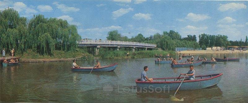
A collectible 1972 postcard capturing summer recreation on the Khorol River in the resort town of Myrhorod, Poltava Oblast.
What is shown on the postcard
The image shows the waters of the Khorol River with numerous wooden rowboats carrying holidaymakers. In the background, a reinforced concrete bridge on vertical supports spans the river. On the left bank, dense weeping willows grow near a small wooden pier. On the right bank, a sandy beach with shade canopies and people is visible.
Historical note
The Khorol River has historically been the main water axis of Myrhorod. With the development of the balneological resort, founded in 1917 by doctor Ivan Zubkovsky, the riverbanks became a central recreation zone. During the Soviet period, extensive leisure infrastructure was established here, including a public beach and a boat rental station.
Present day
Today, the Khorol River and the adjacent park zone remain key attractions for residents and visitors of Myrhorod. The bridge continues to serve as a pedestrian and transport link, and the waterfront area has been modernized to meet contemporary resort standards.
Location (map)
Address: Hoholia St, Myrhorod, Poltava Oblast, Ukraine
Coordinates: 49.961400, 33.608400
(Google Maps)
Coordinate source: Bridge over the Khorol River near the resort park and city beach.
Questions and answers
- Which river is depicted on the postcard? The postcard depicts the Khorol River flowing through the town of Myrhorod in the Poltava Oblast.
- What bridge is visible in the background? The background shows a reinforced concrete bridge over the Khorol River connecting the resort park area with the city beach.
- What year was this photo taken? The photo dates back to 1972, corresponding to the period of active development of Myrhorod’s Soviet resort infrastructure.
See also
The «Old Postcards» archive includes other views of Myrhorod from 1972.





Reviews
There are no reviews yet.