
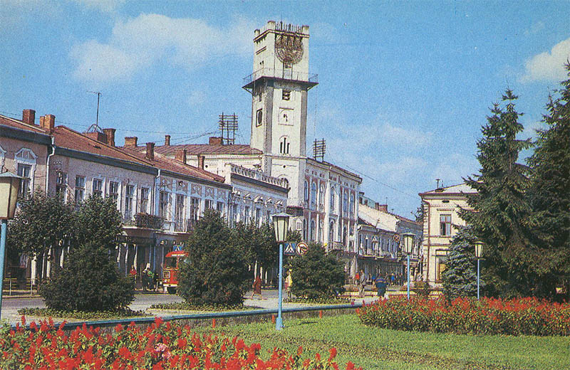
This 1987 postcard shows the regional museum, while the series caption assigns the subject to Kolomyja although the building is in Ivano-Frankivsk.
What is shown on the postcard
The image features a museum building with a ceremonial facade. The architecture and card caption identify it as the oblast regional museum, not a Kolomyja site.
Historical note
The Ivano-Frankivsk regional museum (former Stanislaviv) holds collections on Prykarpattia, Galicia, and the Carpathians. Catalogue mislabelling is common in mass-produced view series when neighbouring cities were confused. Kolomyja and Ivano-Frankivsk share a transport axis along the Prut.
Present day
The Ivano-Frankivsk museum remains a leading regional institution. The card is useful both as a building record and as an example of a catalogue error in the Kolomyja collection.
Location (map)
Address: Halytska Street, Ivano-Frankivsk, Ukraine
Coordinates: 48.922600, 24.711100
(Google Maps)
Coordinate source: Open map data, Ivano-Frankivsk.
Questions and answers
- What is shown? The regional museum in Ivano-Frankivsk.
- Why is it in the Kolomyja section? The catalogue mislabels the card; the map shows Ivano-Frankivsk.
- What year? 1987.
See also
The «Old Postcards» archive includes other views of Kolomyja from 1987.





Reviews
There are no reviews yet.