
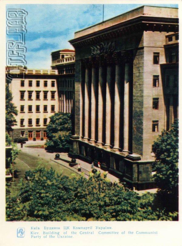
A 1964 Soviet postcard showing the building of the Central Committee of the Communist Party of Ukraine in Kyiv.
What is shown on the postcard
The image shows a massive administrative block with a colonnade and stepped Stalin-era facade; Mykhailivska Square with sparse pedestrians and greenery lies in front. Silhouettes of historic centre buildings appear in the distance.
Historical note
Built in 1934–1937 to designs by architect Pavlo Ryelt as the CP(b)U Central Committee House, it dominated the block near St Michael’s Cathedral and became a key administrative landmark of post-war Kyiv.
Present day
After 1991 the building changed use several times; it now houses state and public institutions. The main facade proportions survive, though the square and surroundings have been rebuilt.
Location (map)
Address: 9 Triokhsviatytelska Street, Kyiv, Ukraine
Coordinates: 50.455556, 30.523056
(Google Maps)
Coordinate source: Open map data, Kyiv.
Questions and answers
- When was the building erected? In 1934–1937.
- Where is it located? On Mykhailivska Square, Triokhsviatytelska Street.
- What year is the postcard from? 1964.
See also
The «Old Postcards» archive includes other views of Kyiv from 1964.





Reviews
There are no reviews yet.