

This postcard from Donetsk, dated 1983, captures a view of the airport.
What is shown on the postcard
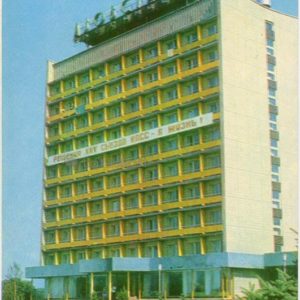
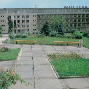
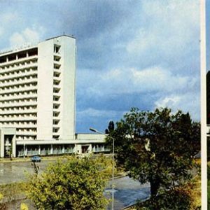
The image shows the building of Donetsk Airport, constructed in the mid-20th century. In front of it lies a well-maintained green area with flowerbeds, and clouds are visible in the blue sky above the structures. The inscription “ДОНЕЦК” is visible in the foreground.
Historical note
Donetsk Airport (Stepanovka) was opened in the 1930s, but the modern terminal building depicted on the postcard was built later. In Soviet times, the airport was a major transportation hub serving both domestic and international flights.
The airport building, visible on the postcard, features characteristic elements of Soviet architecture from the mid-20th century. The inscription “AЭРОПОРТ” (AIRPORT) can be read on the facade.
Present day
Currently, Donetsk Airport is named after Sergei Prokofiev. It has undergone significant reconstruction and expansion, but due to the military conflict in eastern Ukraine, the airport has been non-operational since 2014.
Location (map)
Address: Mitropolit Ilaria Avenue, 1, Donetsk, Donetsk Oblast, Ukraine
Coordinates: 48.084500, 37.779200
(Google Maps)
Coordinate source: Coordinates provided based on publicly available mapping data for Donetsk Airport..
Questions and answers
- When was Donetsk Airport built? The first airport was opened in the 1930s. The building shown on the postcard was constructed later, during the Soviet era.
- What is the airport called now? Currently, the airport is named after the renowned composer Sergei Prokofiev.
- Is Donetsk Airport operational at present? Due to military actions, Donetsk Airport named after S. Prokofiev has been non-operational since 2014.
See also
The «Old Postcards» archive includes other views of Donetsk from 1983.


Reviews
There are no reviews yet.