
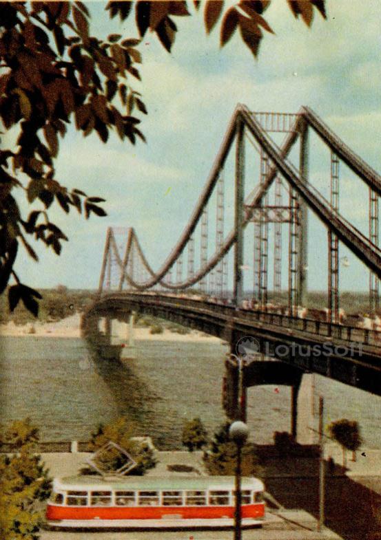
Soviet collectible postcard from 1966 depicting the Parkovy (Pedestrian) Bridge over the Dnipro River in Kyiv.
What is shown on the postcard
The image captures the Parkovy Pedestrian Bridge, which connects the right bank of Kyiv with Trukhaniv Island. In the foreground, a red-and-white tram travels along Naberezhne Highway. The composition is framed by green tree branches. The sandy beach of the island and tiny figures of pedestrians on the bridge are visible in the background.
Historical note
The Parkovy Pedestrian Bridge was constructed in 1956–1957 under a project by the Ukrproektstalkonstruktsiya Institute with the participation of the E. O. Paton Electric Welding Institute. It is an all-welded suspension bridge of a unique design that became a vital element of the city’s recreational zone. The tram line on Naberezhne Highway, shown on the postcard, operated until the early 21st century.
Present day
Today, the Parkovy Bridge remains exclusively pedestrian, linking the right bank to the recreational area of Trukhaniv Island. The tram tracks along Naberezhne Highway were dismantled in 2011 during a major road junction reconstruction.
Location (map)
Address: Naberezhne Highway, Kyiv, Ukraine
Coordinates: 50.457222, 30.536944
(Google Maps)
Coordinate source: Coordinates of the Parkovy Pedestrian Bridge over the Dnipro River in Kyiv.
Questions and answers
- When was the Parkovy Bridge in Kyiv constructed? The construction of the Parkovy Pedestrian Bridge was completed in 1957.
- What transportation is visible in the foreground of the postcard? A red-and-white tram traveling along Naberezhne Highway is depicted in the foreground.
- Does the tram line shown on the postcard still exist? No, tram service along Naberezhne Highway was discontinued and the tracks were dismantled in 2011.
See also
The «Old Postcards» archive includes other views of Kyiv from 1966.





Reviews
There are no reviews yet.