
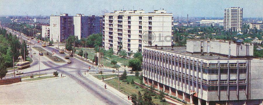
This 1986 view postcard shows the Melitopol highway, a main approach road to Berdyansk.
What is shown on the postcard
The image captures a wide road with traffic, roadside planting, and buildings along the route linking the resort to Melitopol and other cities in Zaporizhzhia Oblast.
Historical note
Roads were improved in the 1980s to support resort and industrial travel. The Melitopol highway was a key Azov transport corridor.
Present day
The highway remains a main route to the city. The postcard records it in 1986.
Location (map)
Address: Melitopol Highway, Berdyansk, Ukraine
Coordinates: 46.748500, 36.775500
(Google Maps)
Coordinate source: Open map data, Berdyansk.
Questions and answers
- What is shown? The Melitopol highway.
- Where does it lead? Links Berdyansk to Melitopol.
- What year? 1986.
See also
The «Old Postcards» archive includes other views of Berdyansk from 1986.





Reviews
There are no reviews yet.