
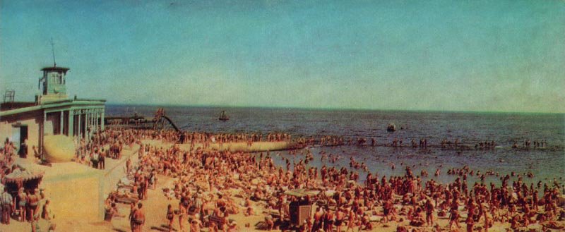
A collectible 1968 postcard capturing the bustling Komsomolsky Beach (now Otrada) in Odesa during the peak of the summer resort season.
What is shown on the postcard
The image shows a crowded sandy beach filled with sunbathers. On the left is a two-story rescue station building featuring a distinctive lookout tower and a spherical decorative element on the parapet. In the sea, a breakwater, a wooden pier with a slide, and several small vessels are visible.
Historical note
During the Soviet era, the beach in the Otrada area was named Komsomolsky. In the 1960s, extensive coastal protection and beach replenishment works were carried out here, creating wide sandy areas and concrete jetties to prevent landslides.
Present day
Today, the area has returned to its historical name, Otrada Beach. The Soviet-era wooden structures have been removed, replaced by modern beach clubs, cafes, and a developed seaside promenade.
Location (map)
Address: Otrada Beach, Odesa, Ukraine
Coordinates: 46.463600, 30.763400
(Google Maps)
Coordinate source: Coordinates of Otrada Beach (former Komsomolsky) in Odesa.
Questions and answers
- Which beach is shown on the postcard? The postcard depicts Komsomolsky Beach in Odesa, now widely known by its historical name, Otrada Beach.
- What is the building on the left side of the image? On the left is a two-story coastal rescue station equipped with a prominent lookout tower.
- What changes have occurred at the beach since then? The beach reclaimed its historical name ‘Otrada’, the Soviet-era wooden piers were dismantled, and the coast is now developed with modern recreational infrastructure.
See also
The «Old Postcards» archive includes other views of Odesa from 1968.





Reviews
There are no reviews yet.