
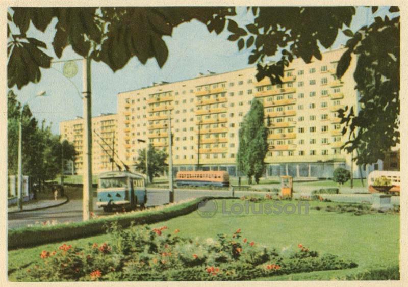
This 1965 Soviet postcard captures a new residential area on Frunze Street (now Kyrylivska) in Kyiv, showcasing the scale of post-war housing development.
What is shown on the postcard
In the foreground, a well-kept lawn with a flowerbed bordered by decorative shrubs is visible. On the roadway, a blue-and-white trolleybus (likely an MTB-82 or similar model of the era) and another transit vehicle in the distance are depicted. The background features multi-story residential buildings built of light brick, featuring balconies and glass-fronted shops on the ground floors. The frame is artistically bordered by chestnut tree branches in the foreground.
Historical note
Frunze Street (historically Kyrylivska) is one of the oldest transport arteries of the Podil district. In the 1960s, it underwent significant reconstruction: new apartment blocks were built for local industrial workers, and tram and trolleybus routes were expanded. This period marked a transition to mass-produced, standardized panel and brick residential architecture.
Present day
In 2015, the street was restored to its historical name, Kyrylivska. Today, the area combines Soviet-era residential blocks, historical landmarks, and modern commercial developments. Public transport, including a busy tramway line, continues to run along this street.
Location (map)
Address: 117 Kyrylivska St, Kyiv, Ukraine
Coordinates: 50.485100, 30.472700
(Google Maps)
Coordinate source: Kyrylivska Street (former Frunze), near buildings 115-119.
Questions and answers
- Which street is shown on the postcard? The postcard depicts Frunze Street in Kyiv (now renamed to Kyrylivska Street).
- What public transport is visible in the picture? A blue-and-white passenger trolleybus and other urban transit are visible on the street.
- What year was this postcard published? The postcard was published in 1965.
See also
The «Old Postcards» archive includes other views of Kyiv from 1965.





Reviews
There are no reviews yet.