
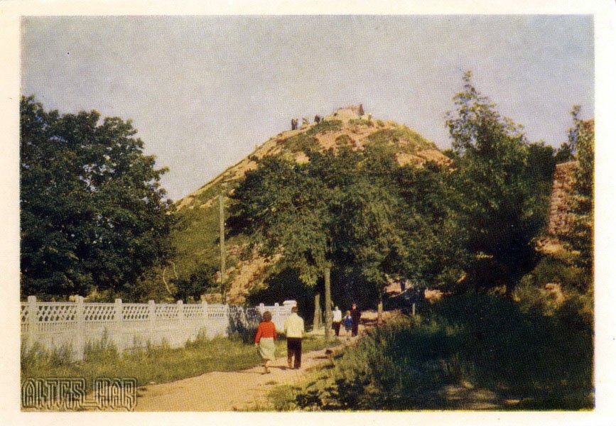
A 1960 Soviet color postcard depicting the path at the foot of the Union of Lublin Mound on High Castle Hill in Lviv.
What is shown on the postcard
In the foreground, a dirt pedestrian path is visible, with people dressed in late 1950s to early 1960s fashion walking along it. To the left is a white decorative concrete fence with trees behind it. In the center rises an artificial mound (kopiec) with sparse vegetation, where silhouettes of visitors can be seen on the summit. On the right, fragments of the historic stone defensive wall are visible.
Historical note
The mound (kopiec) on High Castle Hill was established in 1869 to commemorate the 300th anniversary of the Union of Lublin. Stones from the ruined walls of the old castle were used in its construction. By the mid-20th century, the hill had become a popular observation deck offering panoramic views of Lviv.
Present day
Today, the High Castle Park is a monument of landscape architecture. The observation deck at the top of the mound remains one of Lviv’s main tourist attractions. The Soviet-era concrete fence has been replaced, and the pedestrian paths have been paved.
Location (map)
Address: Zamkova St, Vysokyi Zamok Park, Lviv, Ukraine
Coordinates: 49.848400, 24.039400
(Google Maps)
Coordinate source: Coordinates of the Union of Lublin Mound observation deck on High Castle.
Questions and answers
- What is shown at the top of the hill? The observation deck is located at the top of the artificial mound, where silhouettes of visitors are visible.
- Which event did the construction of the mound commemorate? The mound (kopiec) was established in 1869 to commemorate the 300th anniversary of the Union of Lublin.
- What materials were used to construct the mound? Soil and stones from the ruined walls of the old defensive castle were used to build the mound.
See also
The «Old Postcards» archive includes other views of Lviv from 1960.





Reviews
There are no reviews yet.