
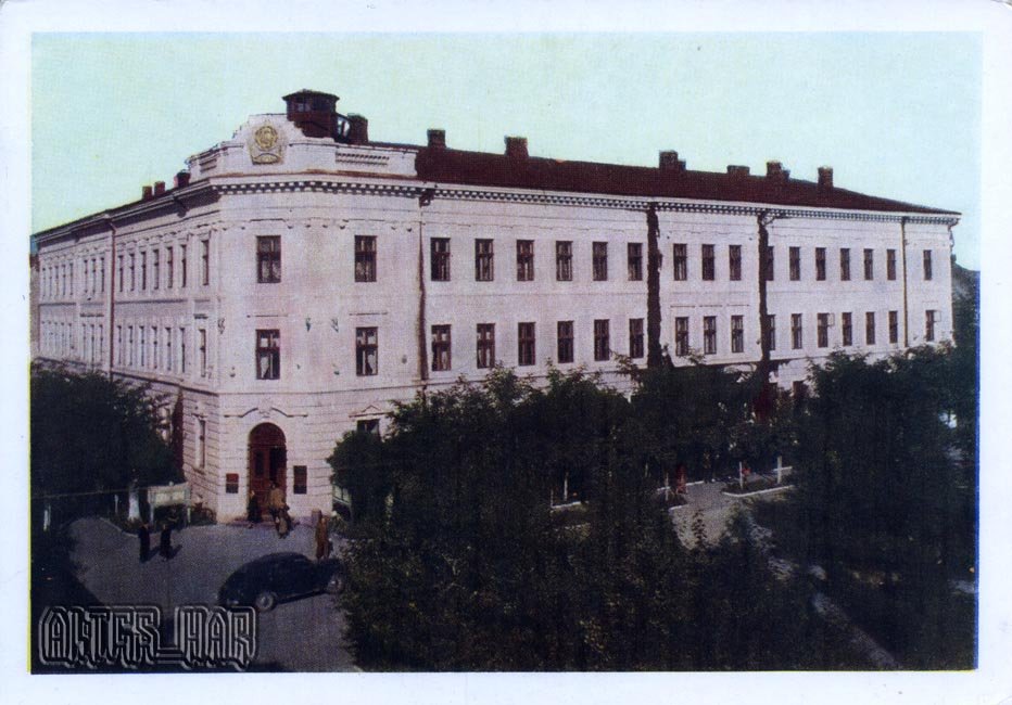
This 1959 postcard shows an administrative building in central Kolomyja, a city on the Prut River in Prykarpattia.
What is shown on the postcard
The image features a multi-storey building with a formal facade typical of post-war Soviet civic architecture, on a landscaped central square.
Historical note
Since the late 19th century Kolomyja developed as a trading and craft centre of Prykarpattia at the crossroads of routes into the Carpathians. After 1939 it became part of the Ukrainian SSR; the 1950s–1960s renewed the city centre.
Present day
Central Kolomyja retains layers of Soviet and earlier architecture. The postcard records the administrative quarter in 1959.
Location (map)
Address: central Kolomyja, Ukraine
Coordinates: 48.529000, 25.041500
(Google Maps)
Coordinate source: Open map data, Kolomyja.
Questions and answers
- What is shown? An administrative building in central Kolomyja.
- What year? 1959.
- Where is the city? On the Prut River in Prykarpattia.
See also
The «Old Postcards» archive includes other views of Kolomyja from 1959.





Reviews
There are no reviews yet.